


Remote Sens. 2024, 16(9), 1598; https://doi.org/10.3390/rs16091598 (registering DOI) - 30 Apr 2024
Abstract
This study extensively examines the estimation of irrigation water requirements using different methodologies based on Earth Observation data. Specifically, two distinct methods inspired by recent remote sensing and satellite technology developments are examined and compared. The first methodology, as outlined by Maselli et
[...] Read more.
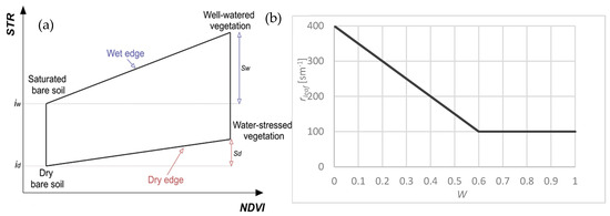
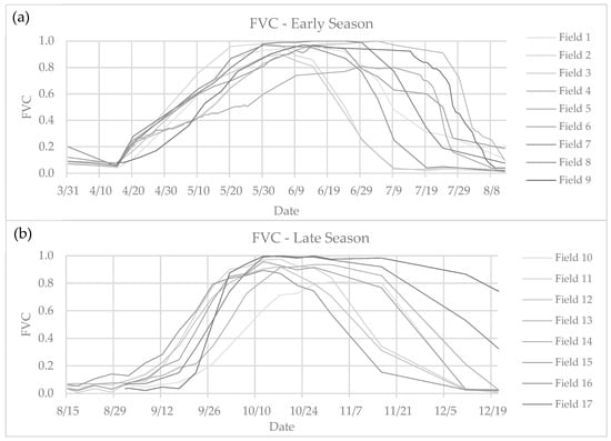
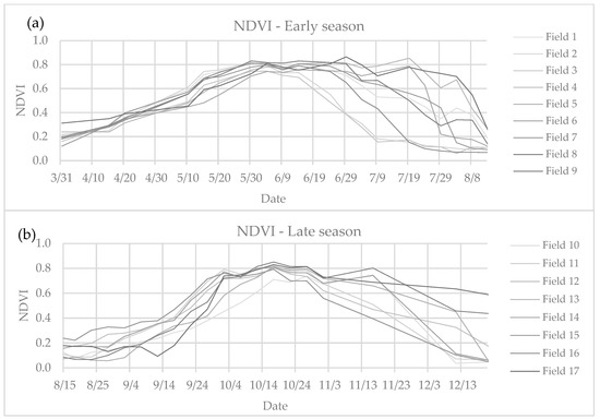
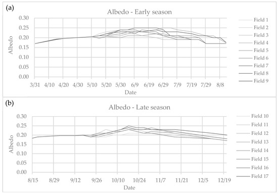
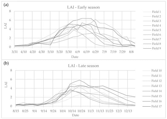
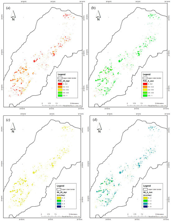
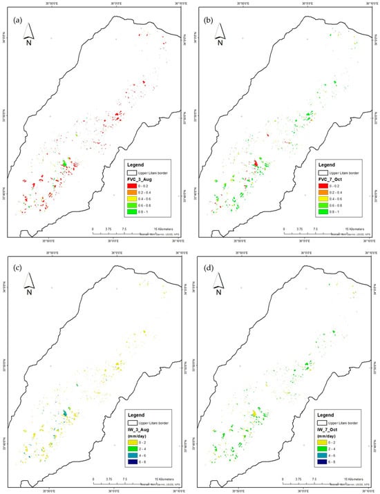
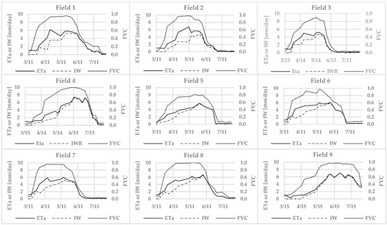
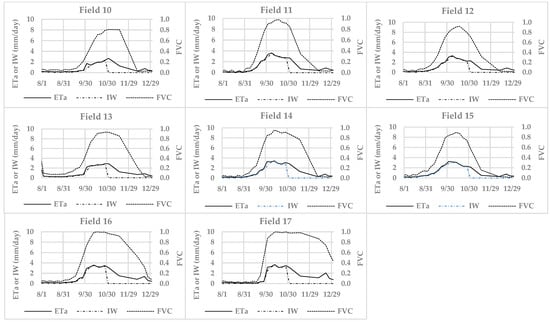
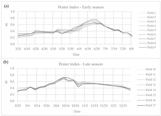
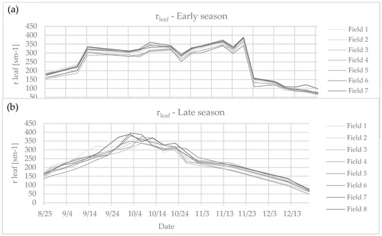
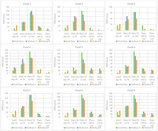
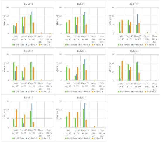
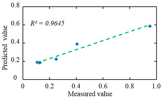
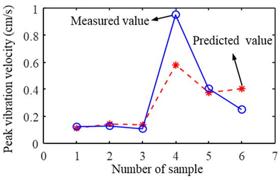
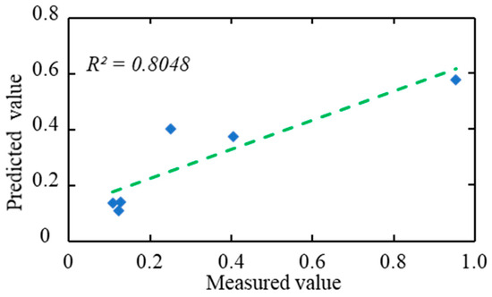
This study extensively examines the estimation of irrigation water requirements using different methodologies based on Earth Observation data. Specifically, two distinct methods inspired by recent remote sensing and satellite technology developments are examined and compared. The first methodology, as outlined by Maselli et al. (2020), focuses on using Sentinel-2 MSI data and a water stress scalar to estimate the levels of actual evapotranspiration and net irrigation water (NIW). The second methodology derives from the work of D’Urso et al. (2021), which includes the application of the Penman–Monteith equation in conjunction with Sentinel-2 data for estimating key parameters, such as crop evapotranspiration and NIW. In the context of the Bekaa Valley in Lebanon, this study explores the suitability of both methodologies for irrigated potato crops (nine potato fields for the early season and eight for the late season). The obtained NIW value was compared with measured field data, and the root mean square errors were calculated. The results of the comparison showed that the effectiveness of these methods varies depending on the growing season. Notably, the Maselli method exhibited better performance during the late season, while the D’Urso method proved more accurate during the early season. This comparative assessment provided valuable insights for effective agricultural water management in the Bekaa Valley when estimating NIW in potato cultivation.
Full article
(This article belongs to the Special Issue Irrigation Mapping Using Satellite Remote Sensing II)
►
Show Figures
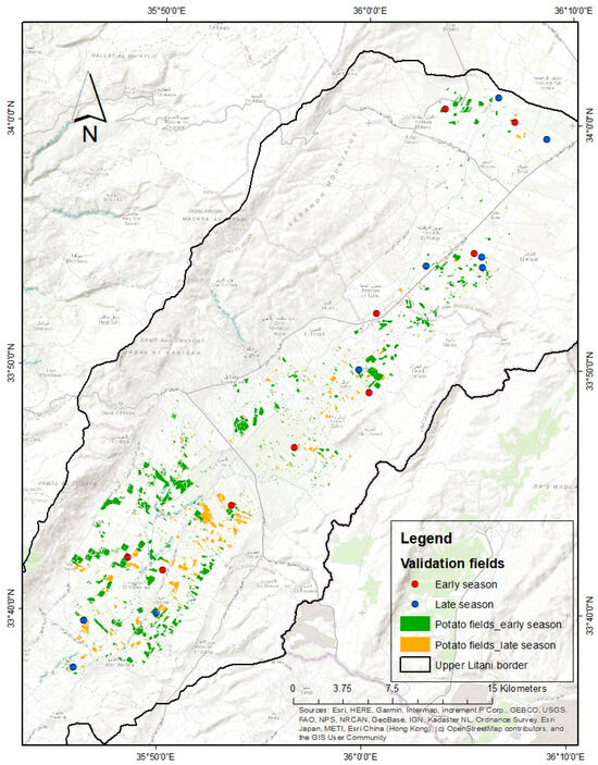
Figure 1
